Waitākere City was a territorial authority in West Auckland, New Zealand; it was governed by the Waitākere City Council from 1989 to 2010. It was New Zealand's fifth-largest city, with an annual growth of about 2%. In 2010 the council was amalgamated with the other authorities of the Auckland Region to form the current Auckland Council.
Coat of arms
West Auckland, New Zealand
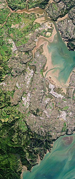
West Auckland is one of the major geographical areas of Auckland, the largest city in New Zealand. Much of the area is dominated by the Waitākere Ranges, the eastern slopes of the Miocene era Waitākere volcano which was upraised from the ocean floor, and now one of the largest regional parks in New Zealand. The metropolitan area of West Auckland developed between the Waitākere Ranges to the west and the upper reaches of the Waitematā Harbour to the east. It covers areas such as Glen Eden, Henderson, Massey and New Lynn.
Metropolitan West Auckland captured by a Planet Labs satellite in 2016
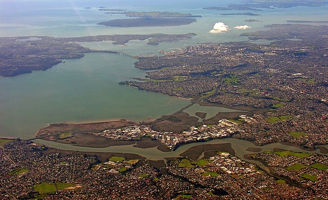
The Whau River has often been used as a border between western and central Auckland
The Waitākere rock koromiko, Veronica bishopiana, is endemic to the Waitākere Ranges
Many early settlements in West Auckland were along the west coast beaches (pictured: Karekare)