Walla Walla River
Videos
The Walla Walla River is a tributary of the Columbia River which runs through portions of eastern Washington and Oregon in the United States. Originating in the Blue Mountains, its two forks merge sou

Confluence of the Walla Walla with the Columbia

South Fork of the Walla Walla River at Harris County Park near Milton-Freewater, Oregon

Hikers on a trail along the Walla Walla River in early winter

The river flooding west of Touchet, February 2020
Missoula floods
Videos
The Missoula floods were a series of cataclysmic glacial lake outburst floods that swept periodically across the area that would become eastern Washington, northern Idaho and northern Oregon, and down
Walla Walla River
…by the river) in the floor of the valley, and above it beds of slackwater deposits named the Touchet Formation. These beds were deposited during the Missoula floods at the end of the Last Glacial Period, when large proglacial lakes burst through the collapsing ice wall in the Clark Fork valley. During these episodes…
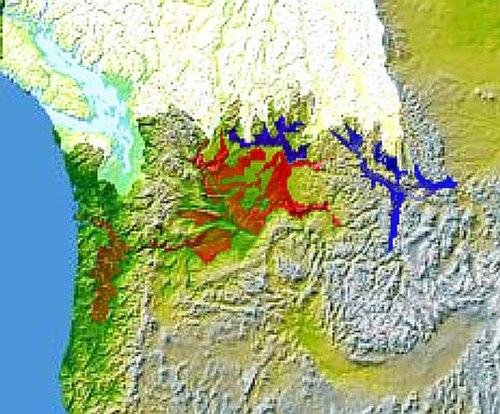
Glacial Lake Columbia (west) and Glacial Lake Missoula (east) are shown south of the Cordilleran ice sheet. The areas inundated in the Columbia and Missoula floods are shown in red.

Giant ripple marks at Markle Pass near Camas Hot Springs, Montana, U.S. View towards the northwest.

During the ice age floods, Dry Falls was under 300 feet (91 m) of water approaching at a speed of 65 miles per hour (105 km/h).

Glacial Lake Missoula high-water mark, 4,200 feet (1,280 m), near Missoula, MT