Western Cape
Videos
The Western Cape is a province of South Africa, situated on the south-western coast of the country. It is geographically the fourth largest of the country's nine provinces, with an area of 129,449 squ

Fynbos in the Atlantic Seaboard, Cape Town

A diagrammatic 400 km south–north crosssection through the Cape at approximately 21° 30' E (i.e. near Calitzdorp in the Little Karoo), showing the relationship between the Cape Fold Mountains (and their geological structure) and the geology of the Little and Great Karoo, as well as the position of the Great Escarpment. The colour code for the geological layers is the same as those used in the diagram above. The heavy black line flanked by opposing arrows is the fault that runs for nearly 300

View of Table Mountain at night.

The Red Disa (disa uniflora) is an orchid endemic to the Western Cape. It is the province's official flower.
White South Africans
Videos
White South Africans are South Africans of European descent. In linguistic, cultural, and historical terms, they are generally divided into the Afrikaans-speaking descendants of the Dutch East India C
Western Cape
…of multi-racial suffrage was later gradually restricted, and eventually abolished, under various National Party and United Party governments. In 1930, white women were enfranchised, and in 1931 property qualifications for white voters were removed. In 1936, black voters were then removed from the common…
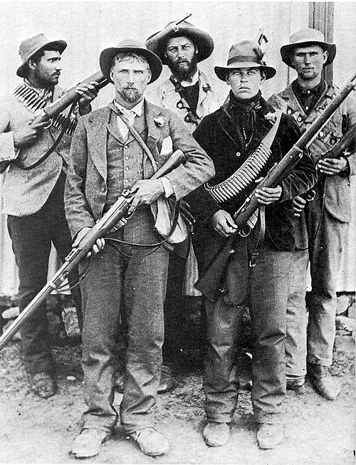
Boer guerrillas during the Second Boer War

Density of White South Africans by district in 1922

White South Africans protest against gender based violence and femicide outside Houses of Parliament in Cape Town

Afrikaners in Pretoria