Wolf Creek Pass is a high mountain pass on the Continental Divide, in the San Juan Mountains of Colorado. It is the route through which U.S. Highway 160 passes from the San Luis Valley into southwest Colorado on its way to New Mexico and Arizona. The pass is notable as inspiration of a C. W. McCall song. The pass is significantly steep on either side and can be dangerous in winter. There are two runaway truck ramps on the westbound side for truckers that lose control of their brakes.
Wolf Creek Pass and Ski Area, August 2008
View to the south into the snaking West Fork of the San Juan River as seen from US 160, halfway up to the pass
The tunnel on the east side of the pass, opened in 2005.
Panoramic view from the Lobo Overlook north of the pass, high on the continental divide, showing Highway 160 and the ski area
Continental Divide of the Americas
The Continental Divide of the Americas is the principal, and largely mountainous, hydrological divide of the Americas. The Continental Divide extends from the Bering Strait to the Strait of Magellan, and separates the watersheds that drain into the Pacific Ocean from those river systems that drain into the Atlantic and Arctic Ocean, including those that drain into the Gulf of Mexico, the Caribbean Sea, and Hudson Bay.
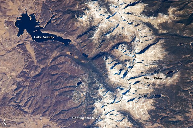
The Continental Divide in the Front Range of the Rocky Mountains of north central Colorado, taken from the International Space Station in October 2008
Grays Peak, at 4,352 m (14,278 ft), is the highest point of the Continental Divide in North America.
The Parting of the Waters in the Teton Wilderness, where one fork flows into the Pacific Ocean and the other flows into the Atlantic Ocean
The Continental Divide Trail often remains above the treeline and on the Divide, providing unobstructed views along its route.